Imagine a jigsaw puzzle. Does it have lots of pieces? Do the shapes of the pieces fit together, with a bulge in one piece matching a dent of the same size and shape in another?
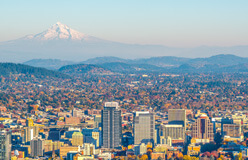
If you have that picture in your mind, you know something about the geography of Oregon – a jigsaw puzzle of shapes and elevations. This state, which borders Washington, Idaho, California, Nevada, and the Pacific Ocean, has six geographic regions. They include lowlands, plateaus, and mountains. The regions are the Coast Range, the Klamath Mountains, the Willamette Valley, the Cascade Mountains, the Columbia Plateau, and the Basin and Range Region. Each region has its own story and its own beauty.
▲ Here, in the Coast Range, are forest-covered mountains, small lakes, and 1,000-foot cliffs. The climate here is the wettest and mildest in the state, which gives rise to the lush forests. The range is an ancient volcanic chain of islands that struck North America 50 million years ago. And stayed. Mary’s Peak, at 4,097 feet, is the highest in the range. The Kalapuya, Native Americans of the region, called the peak tcha Timanwi. That means “place of the spiritual power.”
▲ The Klamath Mountains are named for the Klamath tribe of Native Americans. The mountains are a rugged range with deep river valleys. A wide variety of plants and animals live here. For example, more kinds of cone-bearing trees are here than anywhere else in North America. Hundreds of bird species can be found here also. Plus deer, black bears, and mountain lions.
The Willamette River and others flow through this region from the surrounding mountains. As they flow, they leave sediment, or fertile soil, behind. This has made the Willamette Valley a farming region. Crops include grapes used in making wine, as well as trees for Christmas. Often the destination of early settlers, Oregon’s three biggest cities are in this region. They are Portland, Salem, and Eugene. ▶
▲ The Cascade Mountain region claims several firsts. At 11,239 feet, Mount Hood is the highest peak in Oregon. Crater Lake is the deepest lake in the United States. The Cascade Mountains, which give this region its name, are part of the Pacific Ocean Ring of Fire. This is a path in the Pacific Ocean of frequent earthquakes and active volcanoes. The path runs up along the west coast of South and North America. Then it bends west toward Asia. Oregon’s Mount St. Helens (above), which last had a major eruption in 1980, is on that path.
◀ The rolling hills, fertile soil, and flowing rivers of the Columbia Plateau make it a great place for farming. At other locations, deep river canyons cut into the hills. Hells Canyon (left) is the deepest river canyon in all of North America. It averages 5,500 feet deep. Elsewhere are tall columns of volcanic rock, called basalt. These formed 6–17 millions years ago. At that time, lava from deep in the Earth came up through cracks in the surface. The layers of lava grew and hardened, rising straight up from the land.
▲ You might think you’re looking at the Old West. But it’s a present-day picture of Beatys Butte (be-YOOT). A butte is a hill with steep sides and a flat top. Buttes are the result of soil and rock being worn away by ice, water, and wind. They’re quite common in this part of Oregon. The whole region is made up of about a hundred small mountain ranges that run north and south. The ranges are separated by flat areas. These are called basins. Much of the region is like a desert. That’s especially true in the southeastern part of the state. There, yearly precipitation is only 8–12 inches.