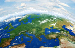
Suppose you made a drawing on an orange peel. To take a photo of the entire drawing, you’d have to take the peel off the orange and lay it flat.
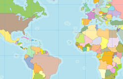
But the photo wouldn’t be exactly like the original drawing. Why? Because when you flattened the peel, it would pull apart, separating the drawing into sections. This is the same problem cartographers, or mapmakers, face when they create maps. What’s the best way to represent our three-dimensional planet in a two-dimensional drawing? Over the years, cartographers have used different map projections to solve the problem. A map projection is a way to show Earth on a flat surface. All map projections distort Earth’s geography, in one way or another.