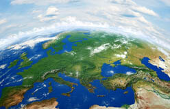
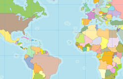
Geography is about Earth’s land, water, air, and living things—particularly people. The word comes from the Greek geo, which means “Earth,” and graphy, which means “writing or description.”
Physical geographers study landforms, water, soil, and climate. They also study the distribution of living things. Human geographers explore the ways people interact with the environment. They may be city or environmental planners, transportation specialists, or market researchers. Read on to discover the role of geography and geographers in Washington, D.C., our nation’s capital.
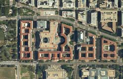
▲ Washington lies between Maryland and Virginia. George Washington picked the site because he wanted to appeal to southern politicians who didn’t want the capital to be too far north. Washington is the only mainland U.S. city that is not part of a state.
▲ Bridges, roads, and rails connect people. The Arlington Memorial Bridge carries over 60,000 vehicles each day. It’s one of several crossings built to keep people and ideas moving across the Potomac River.
▲ The National Mall provides a proper setting for government buildings, museums, and memorials. It’s a public park where people can gather for fun or to exercise their constitutional right of free speech. In 1995, it was the site of the Million Man March. That was a political demonstration calling for unity in the African American community.
◀ People need water for drinking, for cooking, and for bathing. We need it for agriculture and transportation. It’s no wonder that most major cities grew up along the banks of a river. The first people to live along the Potomac River were the Piscataway Indians. In the late 1600s, settlers from Europe started farms and plantations there.
French engineer Pierre L’Enfant was one of the first city planners in the United States. President Washington hired him to create a plan for the capital city. That plan included the location of the Capitol, the White House, and the National Mall. It also included a grid for the surrounding area. African American surveyor Benjamin Banneker and others helped carry out the plan.
Geography Hall of Fame
▲ The northernmost point in the U.S. is Barrow, Alaska.
▲ The border between Canada and the lower 48 states is the longest in the world. It’s 3,987 miles! Alberta is in the western half of Canada, just north of Montana.
▲ The southernmost point in the continental U.S. is Key West, Florida.
▲ At 20,320 feet, Alaska’s Mount Denali (previously known as Mount McKinley) is the highest peak in the U.S.
▲ Lake Superior is the largest body of fresh water in the world.
▲ Death Valley, California, is 282 feet below sea level. It’s the lowest point in the U.S.