Free
Storm clouds and cold fronts are two things that affect daily weather. Such things are always changing.
That’s why weather predictions are only good for about a week ahead of time – if that. On the other hand, climate is mostly the same over decades or even centuries. Why? Because climate is influenced by things that change very slowly, if at all. These things include mountains, oceans, the landscape, and closeness to the equator. Their steady influence makes for regular kinds of weather patterns, and so they create a steady climate.
Winds and Climate
The Earth has regular global winds that follow general patterns. Air warmed by the sun rises. Cold air then takes its place. (Warm air is lighter than cold.) This creates a circular pattern of air, and that creates winds.
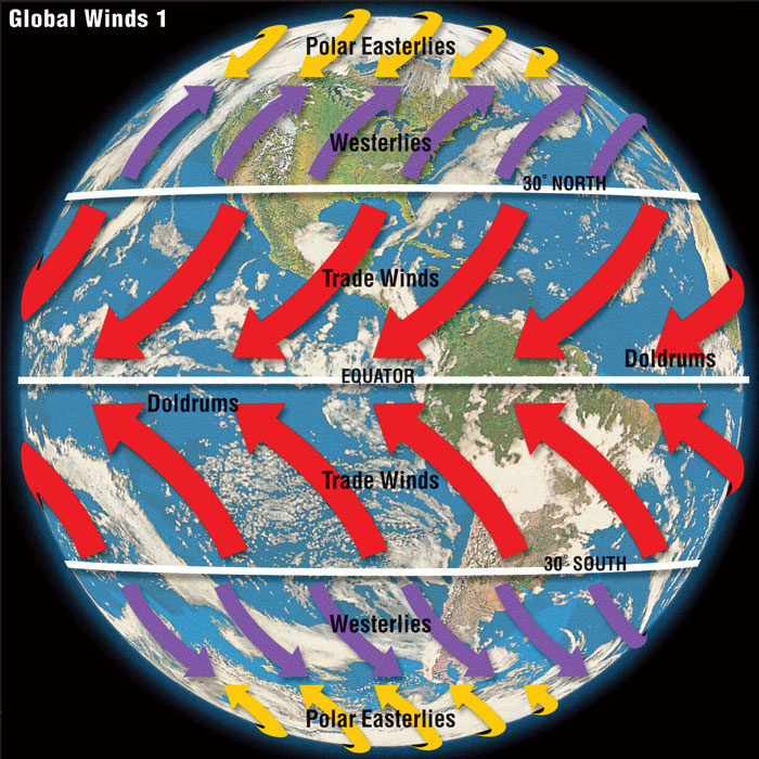
◀ The trade winds, westerlies, and polar easterlies are surface winds. Trade winds come from the subtropics and blow toward the equator. North of the equator, they are called northeasterlies. South of the equator, they are known as southeasterlies. Westerlies are winds in the midlatitudes that blow from the subtropics toward the poles. The doldrums are ocean regions near the equator where the winds are light and unpredictable.
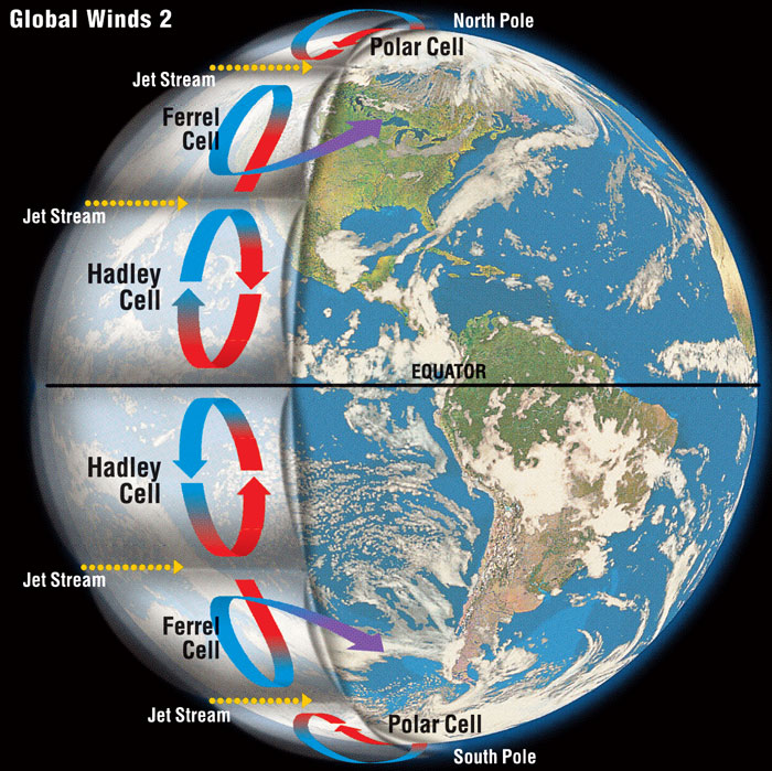
Patterns of rising and sinking air are called Hadley, Ferrel, or polar cells. Here’s how a Hadley cell works: strong sunlight at the equator makes the air very warm. The hot air rises, then spreads out north and south of the equator. The air cools and falls back down at around 30° latitude north and south. As the air falls, it piles up, and the air pressure increases. High air pressure brings dry weather. So, places around 30° latitude are some of the driest on Earth. As you can see on a world map, these areas often contain deserts. ▶
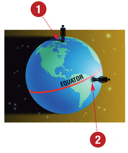
Sunlight and Climate
1. Sunlight becomes less direct as you get closer to the poles. Indirect sunlight delivers less heat to the Earth’s surface. That’s why climates near the North and South Poles are cold.
2. In regions near the equator, the sun travels almost directly above. Direct sunlight is concentrated, focusing a lot of heat on the Earth’s surface. So, climates near the equator are hot.
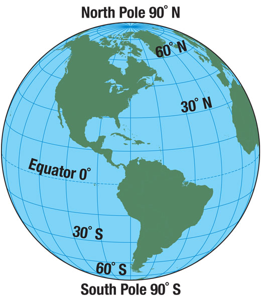
Mapmakers use imaginary lines to mark areas of Earth. Latitude lines go around the planet. The equator marks 0° latitude. The other lines of latitude mark the distance between the equator and the North Pole or the South Pole. ▶
Oceans and Climate
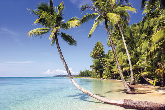
▲ Coastal climates are moderate because of the oceans. Their waters change temperature more slowly than land does. In the fall, inland temperatures drop but warm ocean breezes let coastal areas stay warm longer. In the spring, cool ocean breezes blow. They keep coastal areas from warming up as quickly.
Mountains and Climate
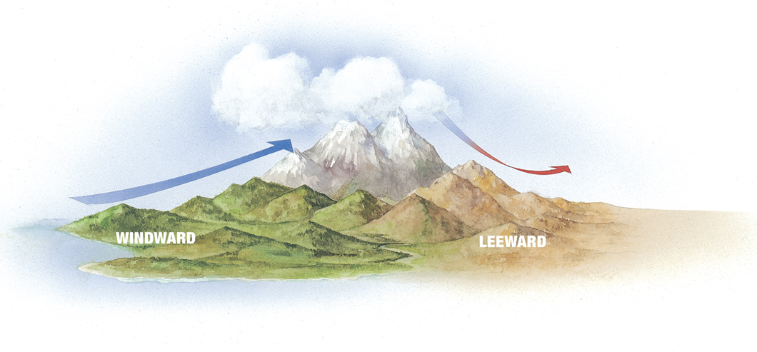
The cool, moist ocean air carries water vapor.
When the air rises, the water vapor forms clouds, then falls as rain or snow.
The now-dry air gets warmer as it sinks.
▲ Mountains force air to rise over them. This rising air is often linked to cloud formation and rain. The rain falls mostly on the peaks or on the windward side (the one the wind blows on). That means the lee (sheltered) side is often dry – an effect called a “rain shadow.”
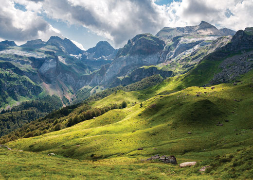
The windward (French) side of the Pyrenees is moist.
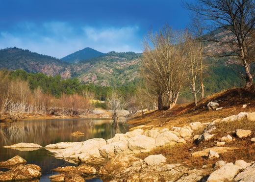
The leeward (Spanish) side of the Pyrenees is dry.
Altitude affects climate, too. As air rises, it gets thinner and cools off. For every 1,000 feet you climb, the temperature drops 5.5°F. A mountain with big, leafy trees at its bottom may have only scrubby plants at the top. It may even have a snow line. Snow never melts above that line – and that means few, if any, plants can grow.
Jet Streams and Climate
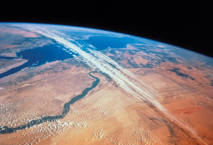
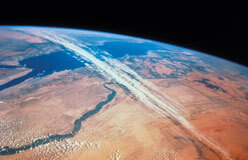
▲ The upper atmosphere has swift rivers of air known as jet streams. They can carry stormy weather with them. This photo shows a jet stream moving clouds over Egypt. (The Nile River is near the middle of the picture.) Jet streams are stronger in winter than in summer. However, they usually flow in regular patterns and affect the weather in fairly regular ways. So jet streams have an impact on climate.