Free
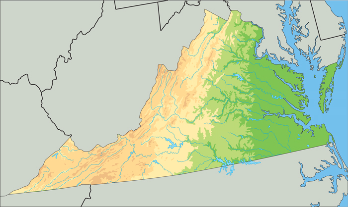
The shape of our state might remind you of a scalene triangle, one with three sides of different lengths.
Our five geographic regions may make you think of five strips, or bands, of land that are more or less parallel to our western border. Moving from east to west, the shape of the land changes from beaches and plains to rolling hills, mountains, and plateaus. By name, these regions are: the Tidewater, or Coastal Plain, the Piedmont, the Blue Ridge Mountains, Valley and Ridge, and the Appalachian Plateau. Let’s have a look.

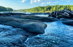
◀ The Chesapeake Bay is the largest estuary in the U.S. (An estuary is a body of water where fresh water mixes with ocean water.) The Susquehanna River and several other major rivers flow into the bay. This is also the area where Jamestown, the first successful English settlement, was located.
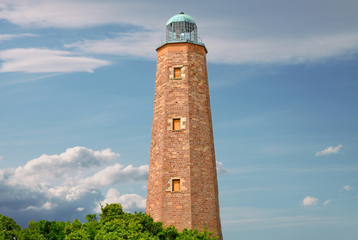
The Cape Henry Lighthouse (right) at the southern tip of the Chesapeake Bay was completed in 1792. This was the first construction project authorized by the U.S. government. It still stands today as a marker for ships approaching the bay during daylight. A second lighthouse was built in the late 19th century. ▶
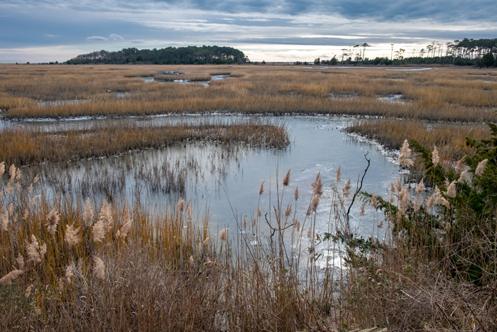
◀ Migrating birds and butterflies find a rest stop at the Eastern Shore of Virginia National Wildlife Refuge. The refuge is located at the south end of the long peninsula that forms the Chesapeake Bay. It includes ponds, salt marshes, woodlands, and grasslands. Mammals such as deer also find their way to and through the refuge.
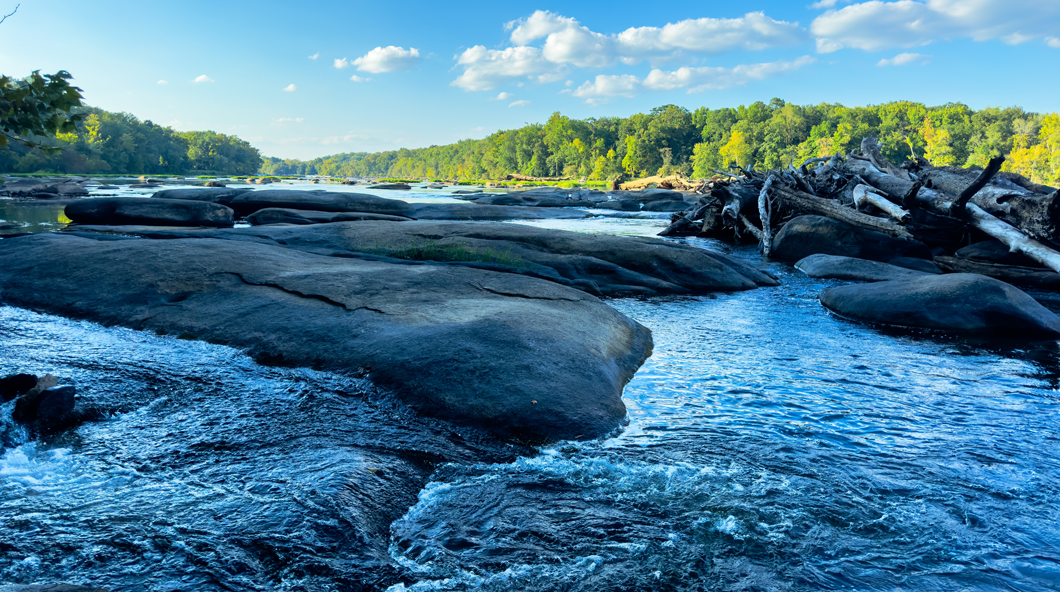
▲ West of the Tidewater region is the Piedmont. Its name means “foot of the mountain” in French. The Piedmont extends west all the way to Virginia’s mountains. To the east, the Piedmont drops off abruptly at the fall line that separates it from the Tidewater. (A fall line is a place where rivers, waterfalls, and rapids spill over hard rock as they flow toward the ocean.) The Piedmont itself is Virginia’s biggest region. It features rolling hills that rise as they approach the Blue Ridge Mountains.
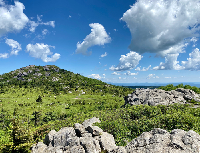
The Blue Ridge Mountains are among the oldest mountain ranges on Earth. At the time they formed, about 1 billion years ago, they included some of the world’s tallest peaks. Over time, the mountains have worn down considerably. Even so, they include Mount Rogers (right), Virginia’s highest peak, which is just over a mile high. The name of the mountains comes from the fact that from a distance they look blue. Part of the Appalachian Trail – the longest hiking trail in the world – passes through the Blue Ridge Mountains. ▶
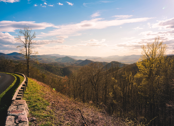
◀ The Valley and Ridge region of our state is complete with caverns, caves, and hot springs. These features developed from soft rock, such as limestone, that is easily broken down by water. As its name suggests, the Valley and Ridge region consists of mountain ranges and valleys of rich soil. The Shenandoah Valley, home to Shenandoah National Park, is among the most well-known areas in this region. Skyline Drive (left), within the park itself, is a well-traveled road with plenty of views of the valley.
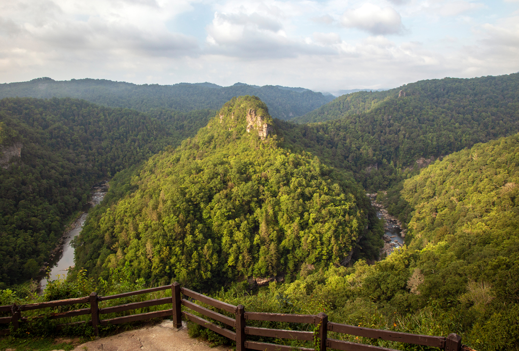
▲ The Appalachian Plateau is the smallest region in Virginia – though nationally it stretches from New York to Alabama. It covers the southwestern part of the state. From a distance, it may look like a mountain range, but it’s not. It’s a plain with a high elevation. The higher parts of the plateau contain natural gas, coal, and oil deposits. These were formed millions of years ago.