Free
Dig down almost anywhere in our state and you’ll find rich soil. Much of it contains clay minerals called illite.
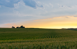
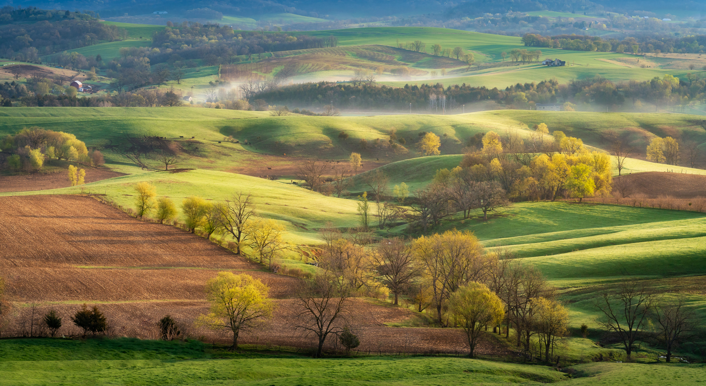
These minerals help make the soil fertile, just right for farming. So it’s no wonder Illinois is an important part of a region known as the Corn Belt. Agriculture, especially corn and soybeans, remains a major part of Illinois’s economy. The topography, or physical shape of the land, includes rolling hills, prairies, and river systems. Much of it is the result of glaciers dating back to the ice age.
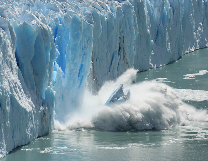
◀ The last ice age ended 10,000 years ago. Before then, more than three-quarters of Illinois was covered in glaciers. Glaciers are thick masses of ice that move slowly and spread across the land. They covered most of Canada and much of the north-central part of the United States. As glaciers move, they move the land underneath them. In Illinois, they carved up the land to make way for what would become our rivers and Lake Michigan in the northeastern part of the state. In other areas, they flattened the land that would become the prairie.
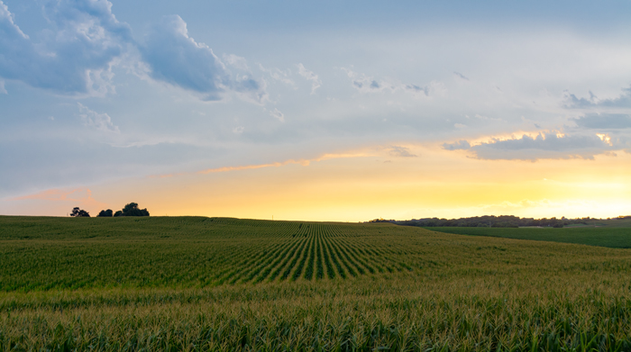
Illinois is known as the Prairie State, and the Central Plains is the reason. This vast area of low, flat land covers more than 90 percent of the state. The soil is made up of sand, clay, silt, and rocks left by glaciers as they melted. (Silt is a fine mixture of bits of rock and minerals that helps make the soil rich.) As a result, the land in Illinois is just right for farming crops like corn. ▶
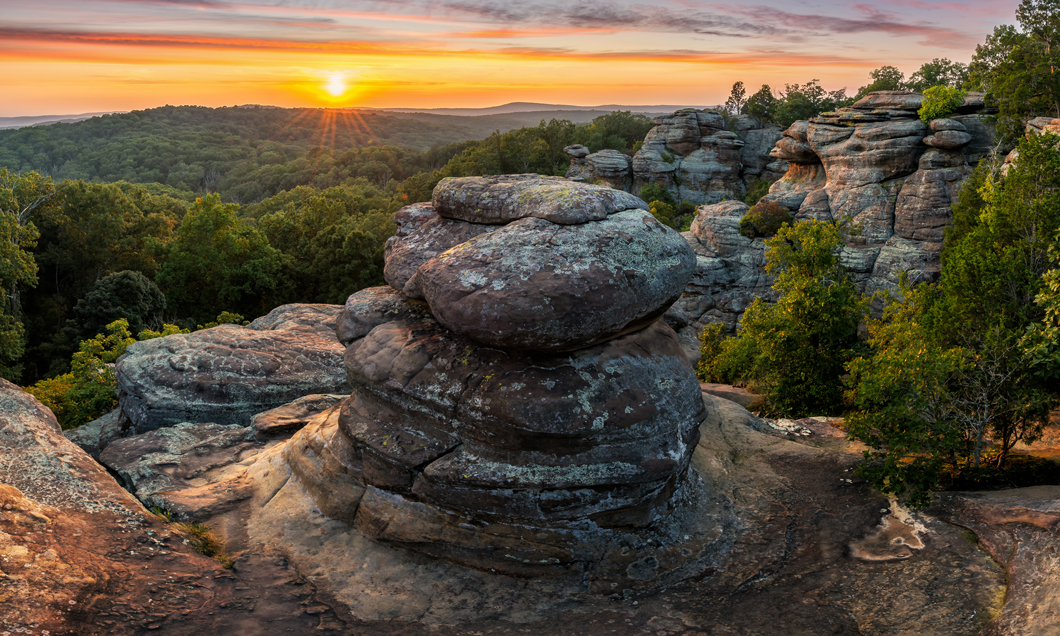
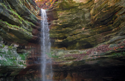
▲ Like the Driftless Area, Shawnee Hills in southern Illinois is also a region untouched by glaciers. It’s a rugged area in the most heavily forested part of the state. Little Grand Canyon in Shawnee National Forest is here. The forest is marked by sandstone cliffs, caves, rock projections, and clear lakes fed by clean spring water.
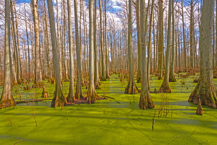
◀ South of Shawnees Hills is the Southern Illinois Lowlands. This region is actually the northernmost part of the Gulf Coastal Plain. That’s an area in the southern U.S. that was once covered by the waters of the Gulf of Mexico. Much of the land is swampy forests. Here, you’ll find many plants and animals you won’t find anywhere else in Illinois. The lowest point in the state is here, just 279 feet above sea level.
Loading the player...
▲ Illinois is a state whose shape is defined mostly by water. The Mississippi River forms the western border and flows south almost 600 miles. There, it meets the Ohio River, which forms the southern border. The Wabash River carves the state’s southeastern border, while Lake Michigan defines the northeastern edge of the state. Fittingly named, the Illinois River (above) flows entirely within the state.