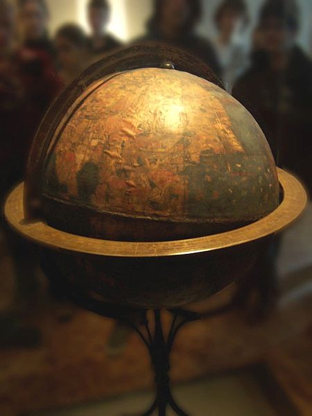
The Nürnberg Terrestrial Globe is the oldest existing scale model of Earth. Known as the Erdapfel (meaning "Earth apple"), it was created around 1492 by German explorer Martin Behaim and painter Georg Albrecht Glockenthon.
 Many details of Behaim's life are not completely known, but around 1480 he traveled as a merchant to Portugal, where his reputation as a student of terrestrial and celestial map-making scored him a job as a navigation adviser to King John II. In those days, the navigational instrument known as an astrolabe was made of wood, and Behaim is thought to have introduced an improved version made of brass.
After traveling along the coast of western Africa with fellow explorer Diogo Cão, Behaim returned to his hometown of Nuremberg in 1490 and started work on the Erdapfel. Although he aimed to incorporate such up-to-date features as longitude lines (aka meridians) and an equator, the globe did not include the Americas, because Europeans hadn't "discovered" those continents yet.
The Erdapfel was also covered with drawings and text that provided details of mythological lands, stories, creatures, and resources taken from historical sources such as Ptolemy and Marco Polo. It reinforced Christopher Columbus's view of the world, because Behaim drew his ideas from the same sources. In fact, the globe put much of what 15th-century European scholars knew about the world in one place.
With so many errors on it, the Erdapfel wouldn't be very useful now for practical things like navigation or doing your geography homework. But the globe is still very important to historians, because it incorporates most of what Western civilization knew about Earth at that time. And, although it is not very accurate, its axis does tilt at the correct angle.
